Within Environmental Geosciences, Geophysical Fields provide critical insights into the forces and processes that shape our planet, from Earth’s magnetic and gravitational fields to the flow of heat within its interior. Understanding these geophysical phenomena is essential for interpreting Earth’s structure, geodynamic processes, resource exploration, and environmental change. A strong grasp of these concepts is crucial for UGC-NET/JRF, SLET, ARS, GATE, and other competitive examinations.
Use this curated MCQ bank to test your conceptual understanding, identify weak areas, and sharpen your exam readiness.
Syllabus Outline
- Basics of geophysics, fundamental principles, Earth’s structure, and geophysical exploration methods.
- The study of seismology (e.g. seismic waves, earthquake monitoring and prediction).
- Examination of gravity and magnetic fields with a focus on properties and applications.
- Resistivity and conductivity measurements.
- Geophysical well logging techniques and interpretation.
- Integration of remote sensing and GIS in geophysics for environmental studies.
- Applications of environmental geophysics in groundwater exploration, contamination assessment, and soil characterisation.
Quick Study Guide
Quantitative analysis of Earth’s physical fields provides non-invasive insights into lithospheric structures, hydrogeological systems, and geohazards. These frameworks evaluate the mechanical, thermodynamic, and mathematical principles that govern anomalous field readings and subsurface profiling across distinct spatial scales.
- Seismic Wave Elastodynamics: Subsurface profiling evaluates compressional primary waves (P-waves), shear secondary waves (S-waves), and dispersive surface Rayleigh waves. Elastic wave propagation is inherently modified by seismic anisotropy (directional velocity variations) and seismic attenuation (anelastic energy absorption within fluid-filled or fractured porous media).
- Seismic Processing and Tomography: Structural geometries are resolved by applying seismic migration to correct geometric distortions of dipping layers. Subsurface velocity variations are then modelled by transforming travel-time datasets through seismic tomography, seismic interferometry (cross-correlating distinct wavefields), and mathematical seismic inversion.
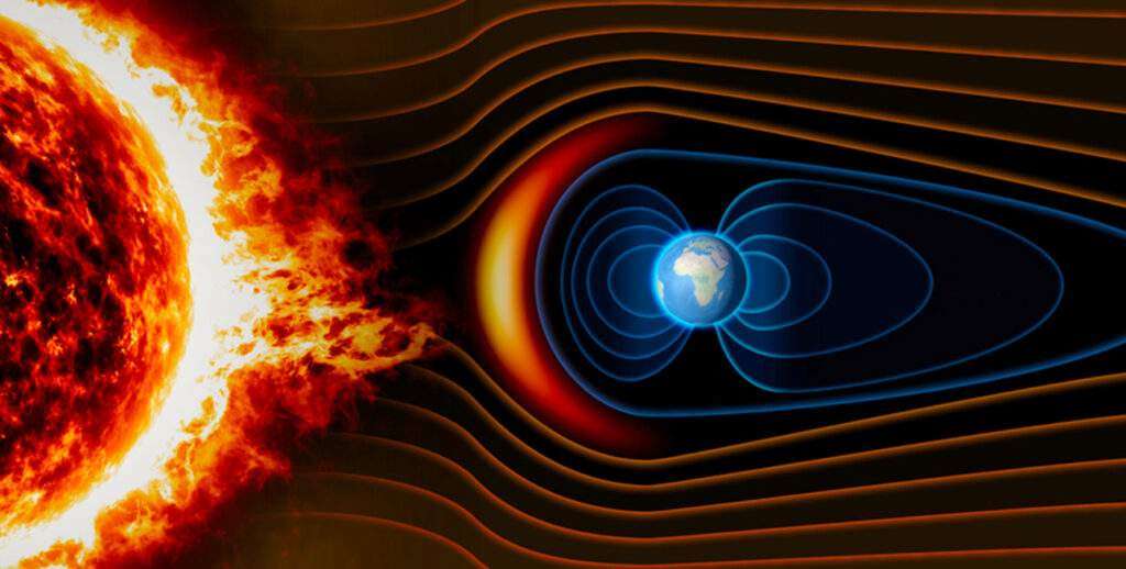
- Geomagnetic Fields and Susceptibility: Subsurface magnetic mapping measures local field variations against the mathematical baseline of the International Geomagnetic Reference Field. Spatial vector dynamics include magnetic declination (the horizontal offset between the magnetic meridian and true geographic north), which varies across strata on rock magnetic susceptibility.
- Thermal Magnetic Thresholds and Anomalies: Induced rock magnetisation drops sharply to zero at the Curie temperature, a distinct thermodynamic limit triggering a paramagnetic phase transition. Subtracting the regional baseline isolates a magnetic anomaly, mapping structural faults, intrusive bodies, and localised mineralisation zones.
- Geodetic Gravimetry and Inversion: Gravitational field variations are quantified relative to the geoid (the global equipotential surface of mean sea level). Adjusting raw data for latitude, elevation, and terrain isolates the Bouguer anomaly, which directly maps subsurface density contrasts that can be multidimensionally resolved using mathematical gravity inversion.
- Hydro-Geophysics and Shallow Geoelectrics: Near-surface profiling deploys Electrical Resistivity Tomography to map fluid saturation via electrolytic conduction. In resistive strata, Ground Penetrating Radar locates shallow voids, fractures, and stratigraphic boundaries via high-frequency dielectric reflections.
- Geothermics and Crustal Radiometrics: Vertically, the geothermal gradient quantifies crustal conductive heat transfer. Geochemical mapping monitors radioisotope signatures (40K, 238U, and 232Th) via gamma-ray spectrometry to evaluate regional radioactive anomalies and background elemental compositions.
Test Your Knowledge
This quiz contains 25 concept-based MCQs on “Environmental Geosciences – Geophysical Fields“. Each question has a single correct/most appropriate answer.
*****
1. The process of seismic interferometry involves:
a) Studying seismic wave diffraction patterns
b) Analysing seismic attenuation in rocks
c) Creating seismic images by combining multiple seismic records
d) Measuring the time taken for seismic waves to travel through the subsurface
2. The Curie temperature is relevant to which geophysical property?
a) Density
b) Electrical resistivity
c) Magnetic susceptibility
d) Seismic velocity
3. The phenomenon of magnetic declination refers to:
a) The angle between the magnetic meridian and the true meridian
b) The variation in magnetic susceptibility of rocks
c) The rate of change of Earth’s magnetic field with depth
d) The intensity of the magnetic field at a specific location
4. The geophysical technique that involves measuring the time taken for a seismic wave to travel through the subsurface is known as:
a) Seismic Tomography
b) Seismic Interferometry
c) Seismic Reflection
d) Seismic Refraction
5. The process of transforming raw seismic data into a subsurface image of velocity variations is known as:
a) Seismic Migration
b) Seismic Processing
c) Seismic Diffraction
d) Seismic Inversion
6. Which geophysical technique is commonly used for detecting and mapping subsurface voids or caves?
a) Ground Penetrating Radar
b) Gravimetry
c) Seismic Reflection
d) Electrical Resistivity Tomography
7. Which property of rocks is most directly related to their magnetic susceptibility?
a) Mineral composition
b) Density
c) Seismic velocity
d) Porosity
8. The concept of seismic anisotropy in rocks refers to:
a) Reflection of seismic waves at subsurface interfaces
b) Changes in seismic velocity with depth
c) Variations in seismic wave amplitudes
d) Directional dependence of seismic properties
9. The P-wave in seismic terminology refers to:
a) Parallel wave
b) Primary wave
c) Pressure wave
d) Perpendicular wave
10. The term geoid refers to:
a) A magnetic anomaly caused by geological structures
b) The subsurface layer with the highest seismic velocity
c) A type of electromagnetic wave used in surveys
d) An equipotential surface representing the mean sea level
11. Which geophysical method is most suitable for detecting buried archaeological features?
a) Ground Penetrating Radar
b) Magnetometry
c) Seismic Tomography
d) Electrical Resistivity
12. Which geophysical method is primarily used for mapping subsurface structures and detecting petroleum reservoirs?
a) Gravity Survey
b) Seismic Reflection
c) Electrical Resistivity
d) Magnetic Survey
13. What property of rocks is primarily measured in a seismic survey to understand subsurface structures?
a) Electrical Resistivity
b) Magnetic Susceptibility
c) Density
d) Seismic Velocity
14. The geophysical method that relies on the principles of radioactive decay to measure subsurface properties is:
a) Gravity Survey
b) Seismic Tomography
c) Gamma-Ray Spectrometry
d) Ground Penetrating Radar
15. The term magnetic anomaly refers to the difference between the observed magnetic field and the:
a) Geomagnetic Equator
b) International Geomagnetic Reference Field
c) Magnetic field expected for a specific location
d) Earth’s magnetic inclination
16. The concept of seismic anisotropy is particularly significant in understanding the behaviour of seismic waves in:
a) Sedimentary rocks
b) Metamorphic rocks
c) Crystalline rocks
d) Igneous rocks
17. The geothermal gradient is highest in regions with:
a) Active volcanic activity
b) Thick sedimentary cover
c) Low seismic velocity
d) High electrical resistivity
18. The S-wave in seismic terminology refers to:
a) Secondary wave
b) Seismic reflection
c) Shear wave
d) Seismic refraction
19. The concept of Rayleigh waves in seismic studies refers to:
a) Surface waves causing ground rolling motion
b) Seismic refractions in sedimentary rocks
c) Seismic waves travelling through the Earth’s core
d) Seismic reflections at subsurface interfaces
20. The geophysical method based on measuring the time delay and amplitude changes of seismic waves is known as:
a) Seismic Diffraction
b) Seismic Interferometry
c) Seismic Reflection
d) Seismic Refraction
21. What does the term seismic attenuation refer to?
a) The reflection of seismic waves at subsurface interfaces
b) The decrease in seismic velocity with depth
c) The absorption of seismic energy as it travels through rocks
d) The amplification of seismic waves in certain geological formations
22. Which geophysical technique is commonly used for mapping faults and fractures in the subsurface?
a) Seismic Reflection
b) Electrical Resistivity Tomography
c) Ground Penetrating Radar
d) Magnetic Survey
23. The term geothermal gradient refers to the rate of change of temperature with depth in the:
a) Ocean
b) Earth’s crust
c) Mantle
d) Atmosphere
24. In the context of geophysics, what property does the Bouguer anomaly represent?
a) Seismic Velocity
b) Electrical Conductivity
c) Magnetic Susceptibility
d) Density Variation
25. The process of transforming raw gravity data into a map of subsurface density variations is known as:
a) Fourier Analysis
b) Wavelet Transform
c) Spectral Analysis
d) Gravity Inversion
*****
Previous: Concept of Minerals and Rocks
Next: Weathering
References
- Edward A. Keller (2022). Introduction to Environmental Geology, Pearson, 5th Edition.
- Sharma, P. D. (2017). Environmental Biology and Toxicology, Rastogi Publications, 3rd Edition.
- De, Anil Kumar and De, Arnab Kumar (2024). Environmental Chemistry, New Age International, 11th Edition.
- Odum, Eugene P., and Barrett, Gary W. (2004). Fundamentals of Ecology, Thomson Brooks/Cole, 5th Edition.
- Singh, J.S., Gupta, S.R., Singh, S.P. & Singh, R. (2026). Ecology, Environmental Science and Conservation, S Chand Publishing, 2nd Edition.
- Erach Bharucha (2017). Environmental Studies, Universities Press, 4th Edition.
🔗 Explore More MCQs: